Google Maps has Some Great New Features for Navigating America’s National Parks
Better Routing, Improved Trail Maps, and Listings of Popular Attractions are Just Some of the Improvements
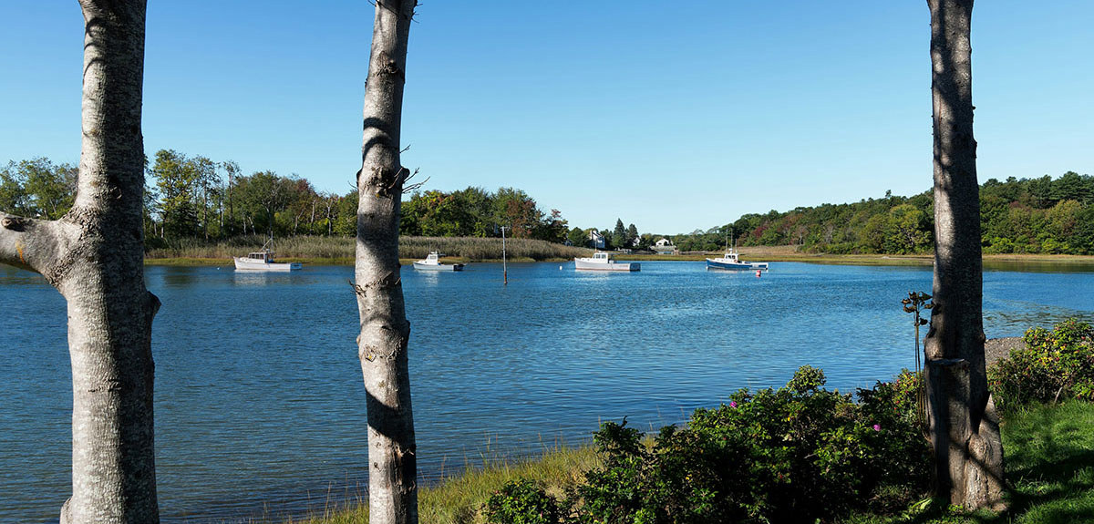
Image Caption: Photo Credit: Kraig Becker
Google Maps is a fantastic tool for route navigation and trip planning, but it hasn’t always offered a good experience inside America’s national parks. Thanks to limited map data and poor internet connections, the service has often been less than helpful in those locations. But thanks to some handy new updates, the internet search giant is looking to change that ahead of the busy summer travel season.
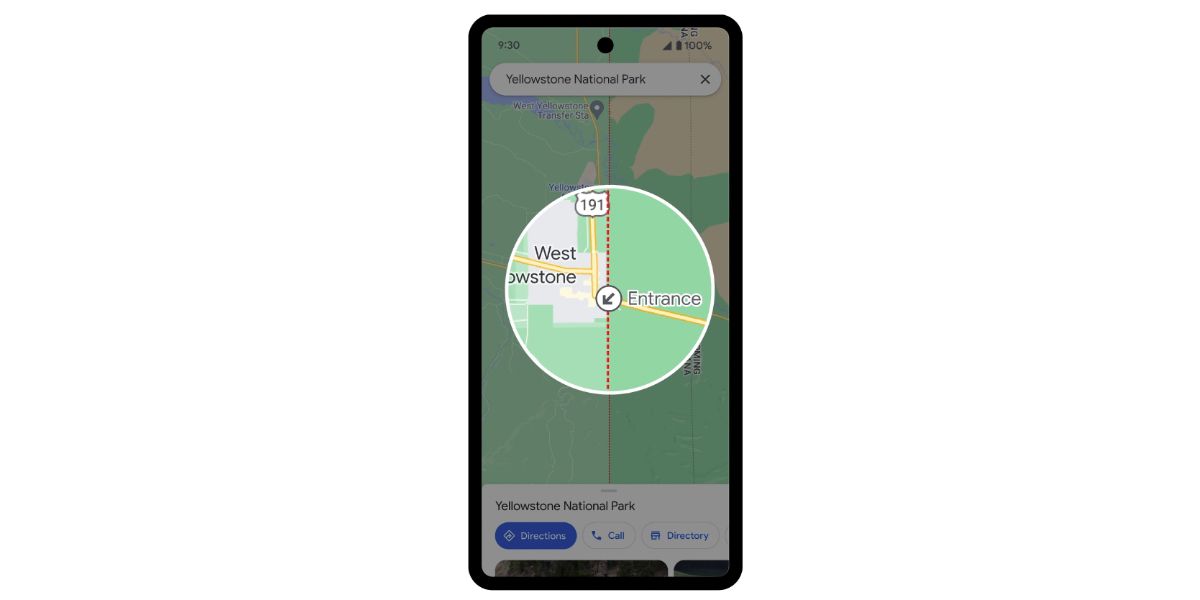
Photo Credit: Google
In a blog post published last week, Google announced four important updates to the Maps iOS and Android apps this month. Those new features should make traveling through the parks more manageable and enjoyable, enhancing the visitor experience along the way.
“After visiting 24 of the 63 U.S. national parks, I know how rewarding it can be to explore the outdoors — whether it’s getting out into nature with my kids or soaking up stunning views on long hikes with friends,” Maps product manager Michel Curtis says in the blog post. “After all these trips, I’m also all too familiar with some of the challenges that come with planning outdoor adventures — like finding the best trailheads or nearest public bathrooms.”
The new features include the following:
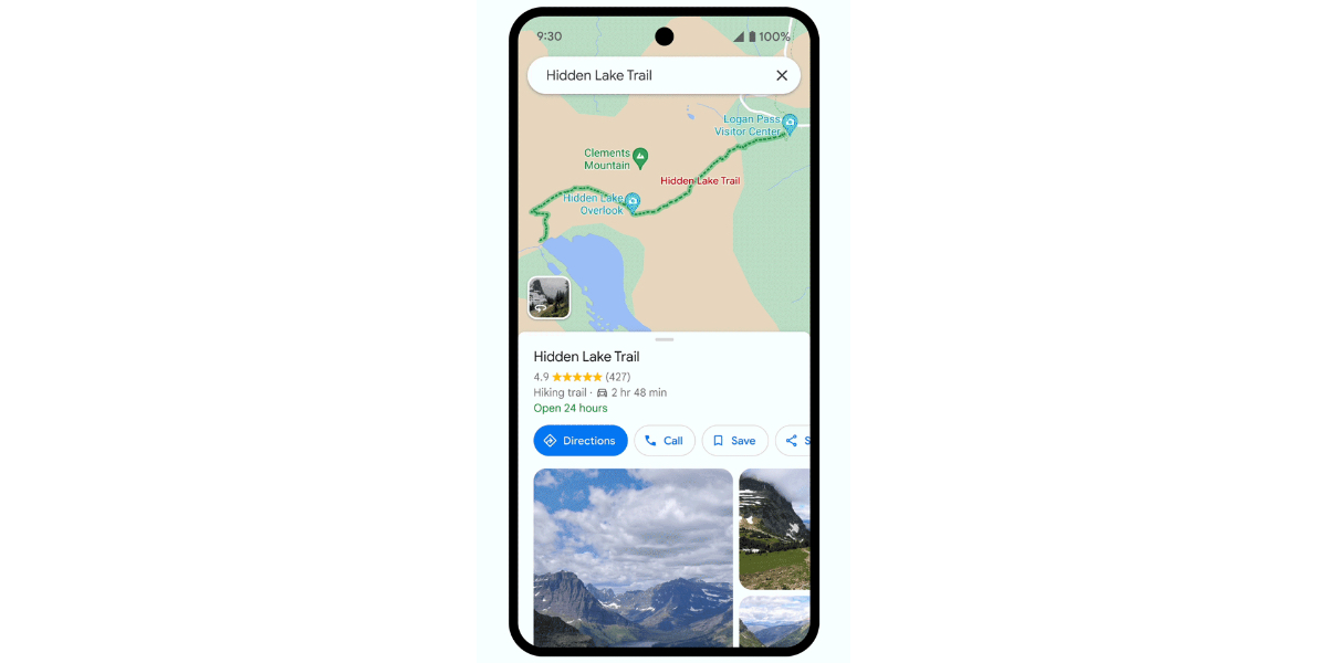
Photo Credit: Google
- Must-Do Attractions: Maps will now provide a comprehensive rundown of the most popular things to see and do inside a given national park. That list will include the locations of visitor centers, campgrounds, top attractions, and trailheads.
- Trail Maps: In the past, hiking trails and other routes were hard to find and follow on Google Maps. But now, those trails are clearly marked from end-to-end, with essential data like distance, difficulty, and type of trail (hiking, biking, equestrian, etc.) displayed.
- Better Driving Directions: Google is also improving navigational information for the roads and highways within the parks, offering travelers better directions as a result. Park entrances will be clearly marked, and driving directions will provide more detail to help motorists get to where they want to go. Visitors can even opt to navigate on foot or by bike, should they choose.
- Offline Maps: Because internet connections are often spotty in the park, Google now offers downloadable maps for offline use. Tapping a prominently-displayed “download” button for an individual park saves the data on your device for use when not connected to a Wi-Fi or cellular network.
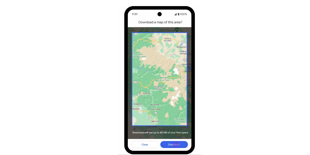
Photo Credit: Google
The updated Maps smartphone apps with these new features will arrive in the next few weeks. Look for them on your favorite mobile operating system soon.

Kraig Becker is a writer in the RV, outdoors, and adventure travel space. Over the course of his career he has contributed to such outlets as Popular Mechanics, Outside Online, Business Insider, TripSavvy, Digital Trends, GearJunkie, The Adventure Blog, and countless others. An avid runner and cyclist, he enjoys camping, hiking, mountain biking, kayaking, and just about any other outdoor activity. His travels have taken him to seven continents and on many amazing adventures.