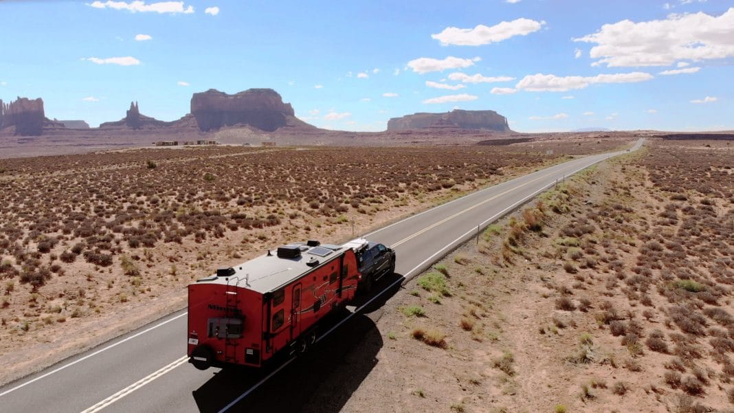
The landscape of North Dakota appears stretched, as if all dimensions except length have been pulled from it. Eons ago, glaciers flattened it to perfection, giving the land a chance to show its immensity to those of us who pass across it here. Lying as a rectangle in the center of the North American continent, farms and ranches cover most of the state. Interstate 94, which I am on, runs to the points of the compass, taking exact azi-muths of due east and west. Looking at a map of the United States, it appears that these 350 miles of interstate across North Dakota make up the longest stretch of straight road in the country. I would think that anything that gives variety to this poker-faced landscape would be prized. Yet when a mound or a pond gets in the way of the road, the road cuts right through it, never yielding straightness to nature. What I am seeing on I-94 this summer’s day speaks volumes about the demographics and commerce in this upper tier of our country.
This is peak travel season, yet there are stretches of road where I see not one vehicle, least of all RVs. A few weeks ago, I was traveling through Nebraska on I-80, the second east/west interstate south of here, and it was loaded with traffic, especially trucks. You might assume that these uncluttered stretches of the American West, these empty miles of road, force the lone traveler to pay attention, lest he get lost in isolation. It’s just the opposite. The grandness of it all demands notice, not just for its scope, but also for its age and its diversity. This boundless landscape prompts a comfortable sense of well-being – so unlike those of places noisier, busier and more filled up. Although it’s the 17th-largest state in the country, encompassing 70,665 square miles, North Dakota ranks 47th in population – 642,200 people.
More people live in the twin cities of Minneapolis-St. Paul in neighboring Minnesota. North Dakota’s economy is based heavily on farming, more than that of any other state except South Dakota. Even its factories process primarily farm products or farm equipment. About 44 of every 100 North Dakotans live in rural areas. The state is the country’s top producer of sunflower seeds. I had never seen a field of sunflowers before, and seeing them in bloom by the acre is extraordinary. Because their faces follow the sun, I couldn’t get in the right place for a good picture. On a failed attempt, I left the highway for an access road. There I came upon four tri-axle grain trucks, each with a flatbed in tow loaded with a huge field harvester, stopped on the shoulder.
The vehicles had Minnesota plates and decals in the windows that read www.johnsonharvesting.com. These are the migrant farm workers of present day, related by occupation and everyday life to perhaps the hobos of the 1920s, 30s and 40s – but that’s where the comparison ends. They live in an air-conditioned bunkhouse on wheels, complete with showers and television. They are young guys, well groomed, tanned and Minnesota-friendly. I made a tentative date with Brent Johnson to meet up with them in Kansas next summer when the harvest season begins. Johnson said that sunflower seeds, which are rich in protein, account for 1/8 of all vegetable oils produced throughout the world.
Sunflowers can grow as tall as 10 feet, and the head can be a foot across. The oil is sometimes used as a replacement for diesel fuel. We know them roasted as snack food, of course, and blended with other grains to make birdseed. The Missouri River enters North Dakota from Montana in the northwest corner of the state, then meanders east before heading south. Much of it delineates the time zones between the Central and Mountain time zones here. Where it crosses I-94 at Bismarck, I headed north on Highway 83 toward Washburn, Stanton and Fort Mandan, the 1804-05 winter post of Lewis and Clark’s Corps of Discovery. Because they wintered here – 146 days that were more night than day – Lewis and Clark spent more time exploring this region than any other.
Here they saw their first prairie dog. They sent several back to President Jefferson with members of their party who returned to St. Louis in the spring. In their honor, State Highways ND 1804 and ND 1806 – the years they traveled here – now trace their paths along the Missouri River. A local historical group has built a replica of Fort Mandan among the cottonwoods on the east bank of the Missouri. The actual location of the Corps winter quarters is upstream and under water, a victim of the wanderings of the river. The fort is triangular. Two sides form living quarters, along with a blacksmith shop and a smokehouse. The third side is a 25-foot palisade with a gate. “Filled with 45 men bundled up for below-zero weather, it must have been like living in a crowded subway,” a tourist said to Gary Anderson, the duty docent. “And no showers,” Gary replied.
Anderson hails from nearby Washburn and dresses in period garb. This is a full-time job for him. “Two women lived here too. This is where Sacajawea’s baby was born. She was recruited with her Canadian trapper husband Toussaint Charbonneau. The second woman was a Native American, like Sacajawea, and another of Charbonneau’s wives.” “I don’t remember reading about the other wife,” I said. “But I do remember that winter was bitter.” “And they were probably the last people,” Gary said, “to come to up here to spend the winter on purpose.”
Bill e-mail address: [email protected].


