Celebrate Canada’s 150th anniversary of confederation along Nova Scotia’s Northumberland Coast and the Cabot Trail
The words “Nova Scotia” evoke an image of an exotic, distant land where wind-swept cliffs rise up from the misty, cold, gray Atlantic, and lush green hills roll down to the rocky shore. On a recent RV trip there with my husband, Mark, those impressions proved true and came to life. However, we had also expected the island to be small and compact, and that was not the case at all. Lying northeast of Maine, and requiring a 200-mile drive across the province of New Brunswick to get there, we arrived to find Nova Scotia is home to a wide variety of lovely coastal and inland scenery and that the distances between the most enchanting spots can be quite lengthy.
On our way to Cape Breton’s famous Cabot Trail on the northeastern tip of Nova Scotia, we meandered along the Northumberland Shore, the island’s northern central coast, and it was a delight. Following the Sunrise Trail (Route 6) from Amherst, we drove along the shoreline, passing wide-open farmland that borders the sea, and catching glimpses of the “real” Nova Scotia that is off the beaten path and far from the tourist crowds.
In the small town of Tatamagouche, we rode our bikes on a wonderful rails-to-trails path through the woods that runs behind the town. What a thrill it was to discover that this wide path is part of the Trans Canada Trail, the world’s longest network of hiking and biking trails, which spans the width of Canada. Still under construction, it will soon be possible to ride a bike on it from the Atlantic to the Pacific to the Arctic oceans.

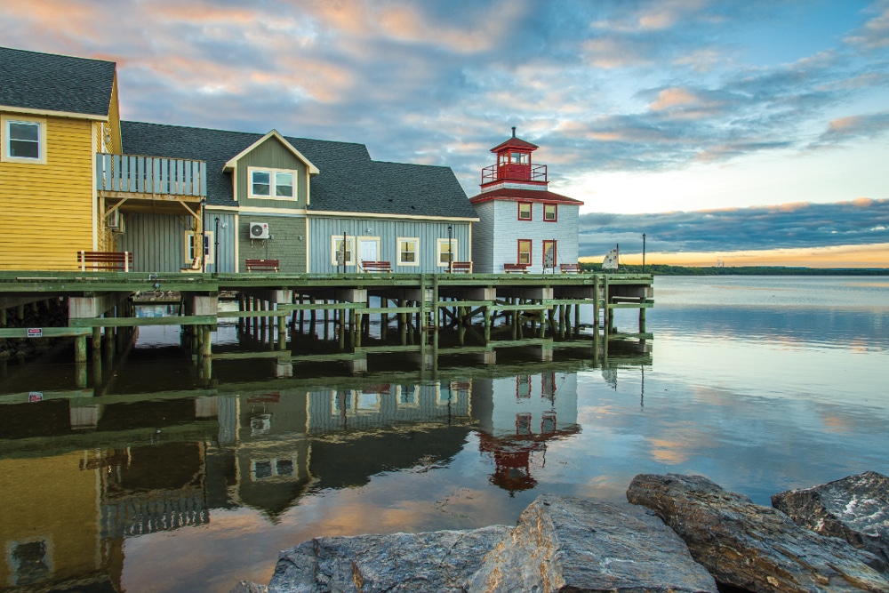
Classic waterfront buildings reflect the peace and tranquility of Pictou Harbor.
We rode over a trestle bridge that gave us views of the bay, and then we came to an old train depot where a series of rail cars were parked on the tracks in front. Both the depot and the train cars have been transformed into a delightful bed-and-breakfast called Train Station Inn. The train station’s former men’s waiting room is now a cute little café, and the dining car serves elegant lunches and dinners.
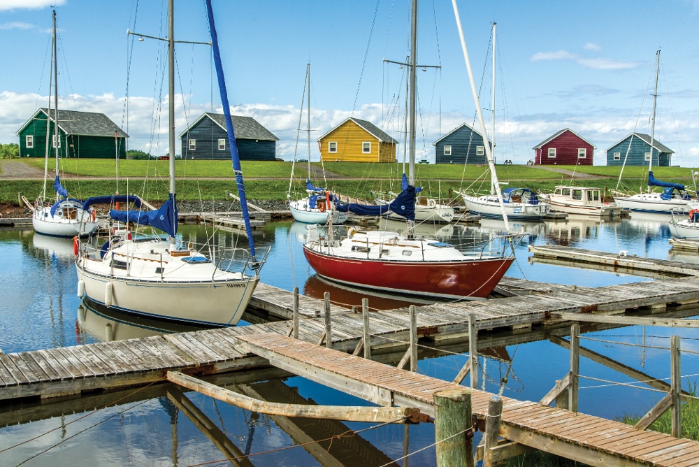
Continuing on the Sunrise Trail eastward along the coast from Tatamagouche, we drove by the pretty Barrachois Harbour Yacht Club, which was filled with brightly colored sailboats ready to take their owners for a day-sail in the Tatamagouche Bay. Then we went through the small settlement of River John and explored the Cape John Provincial Park Reserve. Farther east, our views looked out upon the Northumberland Strait. Prince Edward Island was not too far over the horizon, but was far enough that we never quite saw it.
Leaving the coast behind, the Sunrise Trail turned inland and continued to the historic town of Pictou, which is tucked into a well-protected harbor. Nova Scotia was initially settled by the French in the 17th century and – along with parts of modern-day Maine, the Maritime Provinces and Quebec – this northeastern region of North America was a colony of New France called Acadia.
A century later, in 1773, the initial wave of immigrant Scots arrived and founded the town of Pictou. After that first boat of Scottish colonists landed, the British sent more boats, while the French left their colony on its own. Eventually the Brits outnumbered the French by a large margin. Conflicts arose, and eventually the British exiled the French from Acadia. Some Acadians moved south and settled in Louisiana, where they became known as Cajuns, while others hunkered down in very hostile conditions.
A replica of the boat that carried the first 189 Scots to Nova Scotia is moored in the harbor at Pictou. Watching a colorful sunrise light up this peaceful harbor and taking a bike ride along a shoreline trail made us wonder what life must have been like for those intrepid colonists who first came to live in this land. It is impossible to imagine so many people crammed onto an 85-foot vessel for the terrifying voyage across the Atlantic Ocean, but those early adventurers were determined.
East of Pictou, the Sunrise Trail took us out to the coast once again, and delivered us to the Cape George Lighthouse, a simple beacon that has aided mariners since 1861. The current building is the third lighthouse in that spot (erected in 1968), and the remote and rather barren little hill it stands on was home to four different dedicated lighthouse keepers during more than a century of manual operation.

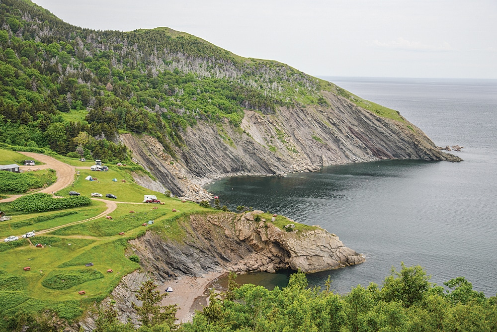
Meat Cove Campground is perched high above the sea on Cape Breton Island.
Heading south from there, we came to spectacular Ballantyne’s Cove, where lush green farmland stretches out on a high plateau overlooking the sea and abruptly drops off in dramatic red cliffs right at the water’s edge. This classic Nova Scotia image was a preamble for the stunning highland landscapes that were to come on the Cabot Trail.
The town of Antigonish is the gateway to Cape Breton Island, and is a fun college town anchored by the pretty campus of St. Francis Xavier University. We were in town for Canada Day, the first of July, and the fireworks display was outstanding. Antigonish is even more well-known for its rendition of the Highland Games (www.antigonishhighlandgames.ca), which have been held every year since 1863 and are a celebration of all things Scottish, from bagpipe and drumming competitions to highland dance competitions to track and field races and clan gatherings. We were not in town for the games, but we found a popular jogging trail at Antigonish Landing on the northeast end of town, where the local college kids and townspeople can get a morning workout.
Crossing onto Cape Breton Island took us into some of the more remote reaches of Nova Scotia. Tuning our radio to a French-language station to get a taste of the local culture, we made our way up the western coast to the town of Chéticamp. This town is primarily of French descent, and we listened with delight as some of the merchants spoke French to their customers and then turned to us and spoke in heavily French-accented English. Yet, while wandering the backstreets of town, we also heard a man singing Gaelic songs and humming to recorded bagpipe music as he puttered around on his porch.
The Cabot Trail is a hilly 185-mile loop around Cape Breton Island, with many 10 percent grades and tight turns that small, strong and nimble motorhomes can drive comfortably – but that RVers in bigger rigs may prefer to tackle as a daytrip with a dinghy vehicle. A big debate is which direction to drive the loop, with the starting point being in the south. To maximize sunlit views of the coastal landscapes, driving counterclockwise will offer sunrise exposure in the east and sunset exposure in the west. It will also place the vehicle in the oceanside lane.
Some of the most stunning scenery is in the northwest quadrant and on the northern tip of the island, so we opted not to do a loop drive but instead to enjoy those impressive landscapes twice in an out-and-back drive, using Chéticamp on the western side of the island as our home base.

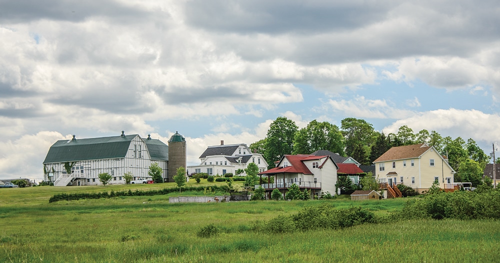
Just in from the coast, Northumberland is lush, flat farmland dotted with barns and silos.
We were just a few miles out of Chéticamp when the breathtaking scenery made our jaws drop. The road soared and dipped through a series of hills and turns, and as we climbed ever higher, the rich green land of the island sheered off in steep rocky cliffs that plunged to the ocean far below. This several-mile-long stretch of road is quintessential Cape Breton Highlands scenery, and driving it on a raw, gray, cold morning enhanced the experience.
Descending from those climactic views, we arrived in Pleasant Bay, a small fishing village where a handful of lobster boats were tied up at the docks. After a brief stroll on the tiny harbor front to stretch our legs, we continued on the Cabot Trail. We had seen signs for moose, but hadn’t expected to see any. So, it was a total shock when we looked up and saw an enormous female moose standing by the side of the road. She was calmly eating the grass and she paused and raised her head when we approached. I scrambled to try to get a decent photo of her, but just as I got her lined up in the viewfinder, she bolted and vanished into the thick woods. Fleeting as it was, what an exciting encounter it was to see a moose so close!
The official Cabot Trail loop cuts across the top of Cape Breton Island and skips the entire northern tip. We decided to take a detour and explore this extremely remote part of the island. Taking a left off of the Cabot Trail and heading north on Bay St. Lawrence Road, we were surprised to see the land suddenly become perfectly flat and the water turn to glass as we passed vast salt marshes.
The road narrowed and eventually turned to dirt in the final few miles as we snaked our way through the woods to the northernmost tip of Cape Breton Island. Then, suddenly, our view opened up and we were staring at a truly majestic vista with the strange name of Meat Cove. The utterly charming Meat Cove Campground was spread out before us on velvety green grass, perched high above the ocean. Along the edge of the grass, jagged slabs of granite sliced their way to the sea, where a tiny sand beach lay at their feet.

The Northumberland coast offers many images of the spirit of the sea.
Each campsite had a stunning view across this rugged landscape of cliffs and rock walls, and everyone was outside in their camp chairs or at their picnic table soaking in the view. Unfortunately, only smaller motorhomes and vans would be wise to make the journey to stay overnight, but what an incredible place to stay for those with an appropriate rig. The view in every direction seemed to come straight out of a brochure.
We retraced our steps back toward the Cabot Trail, making a brief stop at the small fishing village of Bay St. Lawrence. Once we rejoined the Cabot Trail, we continued east to picturesque White Point harbor. Like all the other villages in this corner of the world, fishing and lobstering are the mainstays of this little cove, and several brightly colored lobster boats were moored in the harbor. Red, yellow, orange and blue, there seemed to be one of every color, and they stood out against the dramatic backdrop of green grass, pink craggy granite and gray ocean.
We continued our Cabot Trail highlights tour just a little farther east to the fishing hamlet of Neil’s Harbour, and then turned around to begin our drive back on the Cabot Trail to Chéticamp. The skies remained overcast for our return trip, but in a way the gloominess added to the sense of remoteness and isolation that is the very essence of this harsh coast. There are no big, vibrant towns or soft sand beaches filled with sun worshippers. Instead, this coast is only lightly touched by human hands, and those who reside here live very close to the sea, both in proximity and in spirit.
Nova Scotia is a great destination for an RV road trip, and for us the most interesting and unusual places were well off the beaten path. The less traveled Sunrise Trail along the Northumberland Shore and the Cabot Trail detour to the northern tip of Cape Breton Island will forever stand out in our memories as very special destinations.
RV Parks and Campgrounds

Trail Blazing
The Cabot Trail makes a 185-mile loop around a large piece of Cape Breton Island. Visitors should allow at least eight hours to drive the loop, and spending around three days is recommended in order to take in all the sights.
Baddeck Cabot Trail Campground
902-295-2288 | http://baddeckcabottrailcampground.com
Bras d’Or Lakes Campground
902-295-2329 | http://brasdorlakescampground.ca
Cape Breton Island Provincial Parks
http://parks.novascotia.ca/content/cape-breton-island-parks
Caribou/Munroes Island Provincial Park (No hookups),
902-485-6134 | http://parks.novascotia.ca/content/caribou-munroes-island
Hyclass Ocean Campground
902-232-3117 | https://www.hyclass-campground.com
Linwood Harbor Campground
866-661-9145 | http://linwoodcampground.com
Meat Cove Campground
902-383-2379 | http://meatcovecampground.ca
Parks Canada
902-224-2306 | http://www.pc.gc.ca/eng/pn-np/ns/cbreton/activ/camping.aspx
Plage St. Pierre Beach and Campground
902-224-2112 | http://www.plagestpierrebeachandcampground.com

