RV trips often provide us the opportunity to learn about people and places we vaguely remember from school days long past.
While traveling the coast of Cape Breton Island for a week, my husband, Bob, and I found ourselves following in the footsteps of explorers drawn to these shores for five centuries.
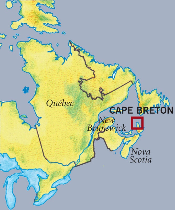
Mid-summer adventures in our 22-foot Leisure Travel Vans Sprinter motor-home led us to the Canso Causeway that links Nova Scotia’s mainland to the island. Once on “Isle Royale,” as 17th-century French settlers named it, we headed northwest to find lunch.
At the town of Judique, the earliest permanent Scottish settlement on the island, we pulled off the road to investigate a handsome building housing the Celtic Music Interpretive Centre. Not only was lunch being served to the assembled crowd, but also three celebrated Cape Breton musicians were about to perform.
We downed bowls of creamy chowder filled with chunks of lobster and scallops, and settled in to enjoy the music. After a round of toe-tapping fiddling by Kinnon Beaton and Shelly Campbell, accompanied by pianist Allan Dewar, Campbell demonstrated Scottish-style step dancing. She invited the audience to learn more through exhibits of vintage musical instruments, photos and recordings.
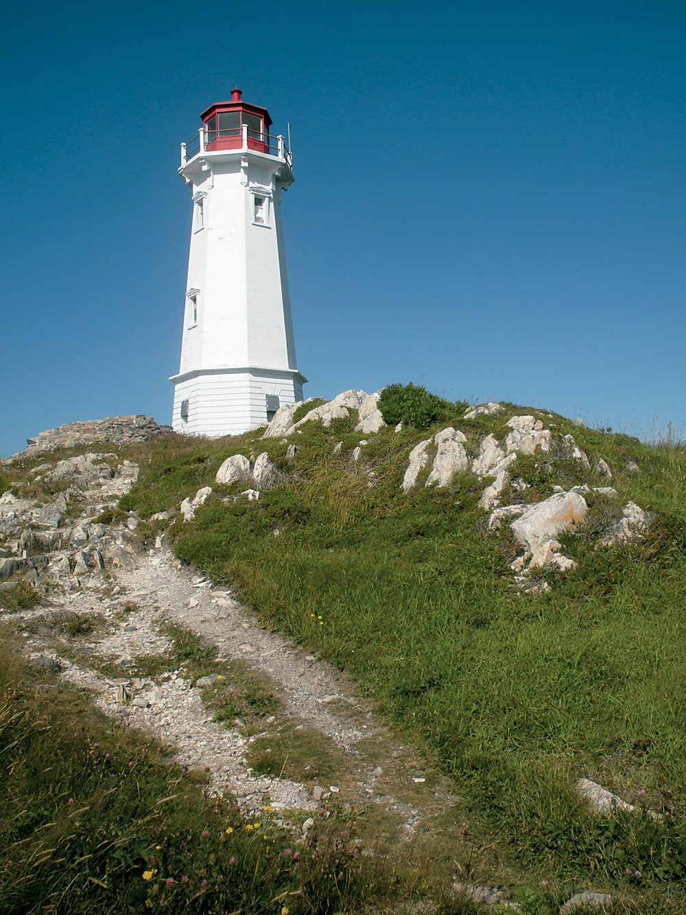
Canada’s first lighthouse was originally built on this spot to stand guard by the harbor entrance to the Fortress of Louisbourg.
Gaelic is still spoken in Western Cape Breton and it’s a region renowned for music that blends its Scottish and French Acadian heritages. Highway 19 is known as Ceilidh (kay-lee) Trail from the Gaelic word meaning party or happening. Ceilidhs and square dances are held all summer at fire stations, community centers and parish halls along this coast.
We continued north on the Ceilidh Trail, pausing to explore the Scottish fishing village and lighthouse at Mabou Harbour before stopping for the night at Inverness. After a walk on a wide beach of silky soft sand, we watched the sun sink into the western sea, a hallmark feature of the “sunset side” of Cape Breton.
Bright sunshine the next morning promised ideal weather for our introduction to a world-famous drive. Looping 185 miles around the northern peninsula of Cape Breton Island, the Cabot Trail is known for its cliffs, mountains and switchbacks, all well worth navigating for the majestic coastal scenery.
We joined the trail at the town of Margaree Harbour and within 20 minutes reached the French Acadian enclave of Cheticamp. Just above, the trail entered Cape Breton Highlands National Park, where rangers gave us a handy guide map with symbols for scenic overlooks.
Pulling over often to drink in the views, we came upon the park’s 20-site Corney Brook Campground perched above the sea and noted it for our “next time” list. At another overlook with a lovely view of the trail, we read a marble monument’s inscription memorializing Canadians who died overseas serving their country. “They will never know the beauty of this place, see the seasons change, enjoy nature’s chorus,” it read.
The trail led inland and we stretched our legs with a short hike through the French Mountain Bog where tiny white orchids were in full summer bloom. Back in the motorhome, we followed the 
forested mountain road into the highlands, and our wilderness views swept down to coves, bays and river valleys.
Although it’s possible to drive the Cabot Trail in a full day, we decided to pause overnight and explore the top of the peninsula. We checked into a campsite overlooking Aspy Bay at the Hideaway Campground & Oyster Market and phoned to arrange a late afternoon whale watching excursion nearby.
On the way, we stopped at the oceanfront Cabots Landing Provincial Park where a grassy field with picnic tables borders a red sand beach. We came upon a bust of John Cabot perched atop a rock cairn erected by the Cape Breton Historical Society. The bronze marker states that on June 24, 1497, the explorer discovered the continent of North America in this vicinity.
Or did he? A government plaque on the ground nearby equivocated: “He made land somewhere on the east coast of Canada.” (Some historians say it was in Newfoundland.) The explorer actually was a Venetian citizen named Giovanni Caboto who bore letters of patent from King Henry VII. Whichever landfall visitors choose to believe in, there’s no disputing that Cabot’s expedition in his small ship, the Matthew, launched Britain’s mighty overseas empire.
Like Cabot, we wanted to explore these waters by boat, and drove to Bay St. Lawrence to board the 42-foot Oshan with 10 other passengers. Captain Cyril Fraser, whose family has lived in northern Cape Breton for five generations, steered us along the north coast of the peninsula and pointed out eagles perched on jagged cliffs that plunged to the water. We passed Meat Cove high above us, where two RVs had ventured up dirt roads to camp at land’s end.
 From the Cape St. Lawrence beacon, Fraser turned north into deeper water where he knew whales might be found. Soon we found ourselves in “whale soup,” pointing and laughing as shiny black pilot whales and their calves spouted, surfaced and dove around the boat. As the sun sank in the sky, Fraser put out lines to trawl for mackerel while his first mate, daughter Cheryl, took the helm into port.
What goes up must come down when it comes to the Cabot Trail since no roads bisect the loop mid-peninsula. We continued our clockwise route the next morning after stopping to marvel at the crystalline water of White Point, typical of Aspy Bay villages where fishermen earn a living from the sea.
Lobster season ended on July 15, and rectangular traps were piled high on wharves at towns like Neil’s Harbour where we parked to see the Canadian Coast Guard’s 1899 lighthouse. Traps shaped like conical lampshades were now deployed for the summer’s catch of snow crabs.
We continued through coastal forests along the rocky bluffs and shallow coves down to the Ingonishes, a series of bay towns offering a beach, resort, golf course and other attractions. We crossed steep Cape Smokey Mountain, still enjoying the rocky shoreline, and passed galleries filled with pottery, woodcarvings, rugs and other handicrafts. At Bras d’Or Lake Camp-ground in Baddeck we stopped for the night.
The Alexander Graham Bell Nation-al Historic Site was a five-minute drive the next morning from our campground and offered RV parking near the entrance. Exhibits inside brought to life the scientist we knew only as the inventor of the telephone. Born in Scotland, Bell became a U.S. citizen and in his later years lived in this Cape Breton town.
Through oral history videos, photos and artifacts, we discovered the vast scope of Bell’s achievements in medicine, aeronautics, marine engineering and communication for the deaf. Exhibits humanized the great inventor, who in boyhood taught his dog to talk and in old age smoked his cigar while floating in a life ring.
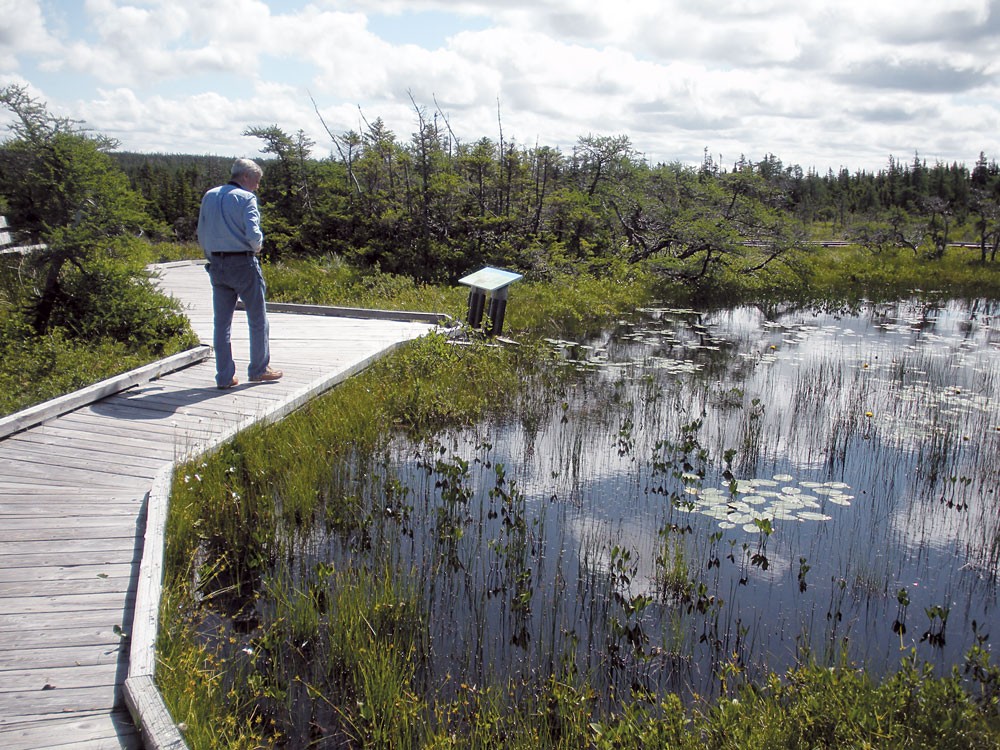
A boardwalk leads to orchids and wildflowers in the French Mountain Bog along the Cabot Trail.
Leaving the Cabot Trail behind, we turned east toward Glace Bay to trace the path of Italian inventor Guglielmo Marconi. All that remains at Table Head where Marconi established his transatlantic wireless station are concrete foundations of a huge transmitting tower. A transmission from the tower in December 1902 was the first radio message from North America to cross the Atlantic. Inside the small National Historic Site museum, we studied a replica and other exhibits about this Nobel Prize winner.
We followed the Marconi Trail’s rugged coastal road south for an hour, crossing a one-lane, wooden plank bridge, to the modern town of Louisbourg for two nights in a fine waterfront campground, Point of View Suites & RV Park. Driving around the harbor the next day, we came upon the modern-day red and white version of Canada’s first lighthouse, originally erected on this site in 1734.
The Fortress of Louisbourg National Historic Site would be our final stop, a living history re-creation much like America’s Colonial Williamsburg. A Parks Canada employee at the visitors center noticed our annual Discovery Passes, handed us the day’s schedule and waved us past dozens of people lined up to buy tickets. We boarded a bus for the 15-minute ride to the fortress and walked to a gate where a costumed sentry granted us entry into the French-speaking world of 1744.
Tour guide Hilda Bagnell explained that codfish were all-important to France and England in the early 1700s. France built the lighthouse and an oceanfront fort on this harbor, named after Louis XIV, to protect its interests in the rich Grand Banks nearby. The fortress and town were of great international significance from 1713 to 1768. But after two major sieges, the French eventually surrendered to the British, who destroyed the fortress.
In 1961 on the abandoned site, the government of Canada rebuilt one-fourth of the original town using original plans, stones and masonry techniques, and opened it to visitors.
We walked cobblestone streets, visited the King’s Bastion Barracks and watched a blacksmith, lace maker and other costumed interpreters at work. After enjoying a children’s dance, we stepped into a small tavern and ordered pea soup and bread served in a pewter dish. Strolling past roaming turkeys and farmers tending their sheep, we visited the richly furnished governor’s quarters and admired his ornate chapel before leaving.
It had been a satisfying day and a fitting end to our week on Cape Breton Island. We had seen Cabot’s coast, walked in the footsteps of Bell and Marconi, and followed the paths of Scottish and French adventurers. Our RV discoveries, more satisfying than any classroom experiences, had made the pages of history come to life.
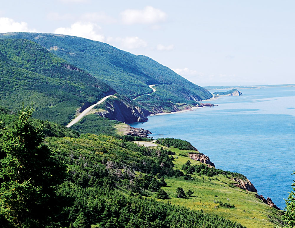
The Cabot Trail winds, climbs and descends along a 185-mile loop around the northern peninsula of Cape Breton Island.
Driving the Cabot Trail
Drivers encounter steep grades, particularly at Cape Smokey Mountain on the Atlantic side. RV travelers can approach the trail clockwise from the west side to drive in the inland lane (or counterclockwise from the east to drive along the guard rail). Some drivers leave their motorhomes parked at campgrounds and drive a dinghy vehicle. The town of Baddeck, with several full-service RV parks, grocery stores, fuel stations and other amenities, is a popular base camp.
At Cape Breton Highlands National Park, two campgrounds offer full hookup sites: Cheticamp on the west side and Broad Cove on the east. Call 902-224-2306 or visit www.pc.gc.ca. A Parks Canada Discovery Pass provides one year’s unlimited entry to 100-plus national parks and historic sites. Prices are $67.70 for adults and $57.90 for seniors.
For More Information
Bras d’Or Lakes Campground
902-295-2329, www.brasdorlakescampground.com
Fortress of Louisbourg
902-733-3552, www.pc.gc.ca
Hideaway Campground & Oyster Market
902-383-2116, www.campingcapebreton.com
Oshan Whale Watch
877-383-2883, www.oshan.ca
Point of View Suites & RV Park
888-374-8439, www.louisbourgpointofview.com