A leaf-peeping tour takes a backseat to the beauty and wonder of the Natchez Trace Parkway
A drive along the Natchez Trace Parkway is exactly the kind of trip I envisioned when I first started RVing – a well-maintained road with no billboards or advertisements to distract from the natural beauty of the countryside. This 444-mile-long drive is something that every motorhome owner should experience at least once.
There are three campgrounds inside the park, which are run by the National Park Service (NPS), and more than a dozen campgrounds just outside of the park. The three NPS campgrounds do not have dump stations, hookups or showers, but they are free, and while no reservations can be made, there are restrooms and water spigots for use within the campgrounds. The spots are on a first-come, first-served basis and do fill up quickly, so stop early in the day and enjoy your campsite.
When I started off in late October heading south from Nashville, Tennessee, my goal was to chase the fall leaf colors and to see every one of the mileposts along the way. The colors were not quite at peak, but there were still some worthy vibrant outbursts here and there. While fall is one of the busiest times on the Trace, there were trails that teased of the promise of spring and how glorious places like Dogwood Valley would be during its blooming time. I can’t imagine there could really be a bad time on the Natchez Trace.
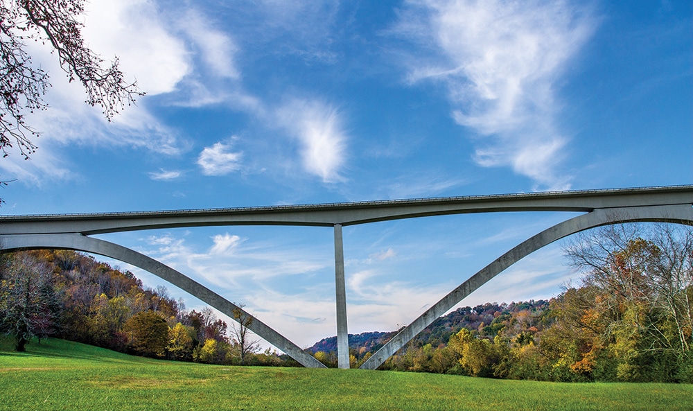
My first sightseeing stop was Birdsong Hollow (milepost 438) and Double Arch Bridge. This bridge is a fascinating first stop since it is the nation’s first segmentally constructed concrete arch bridge and the winner of the Presidential Award for Design Excellence the year after it was completed in 1994. There is a pedestrian lane so that you can cross or just get out far enough to see the view from there.
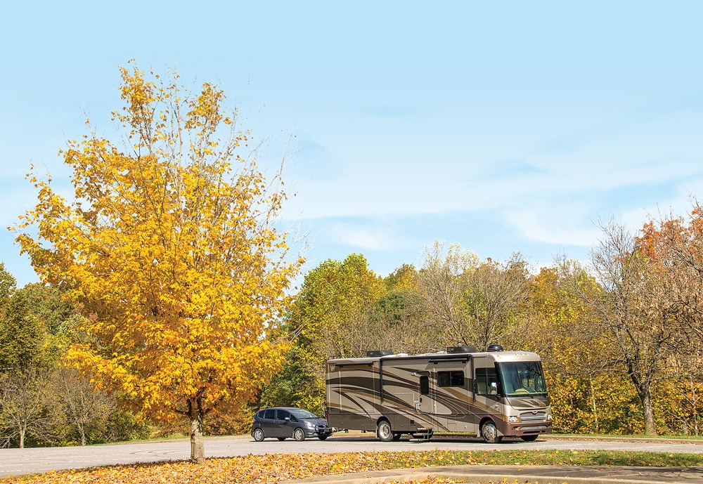
 The Trace is very RV-friendly. As far as bridge underpasses, I checked with the visitor center and was told that the maximum height for travel on the Trace is 14 feet, and that all bridges meet those requirements. I saw a few side roads that specified “No RV Turnaround” but I stopped at every other historic pull-off and picnic area in my 35-foot motorhome with no problem at all.
Jackson Falls (milepost 404.7) turned out to be one of my favorite hikes in this section. The trail is short and steep, but is paved the whole way and has handrails. The destination makes the journey worthwhile, with an amphitheater effect rimming the falls. It’s easy to see why this is one of the most popular walks along the Parkway.
I made it a point to stop for any signs indicating parts of the Old Trace. Many original sections are preserved and you can walk or drive (automobiles only) on portions of it. I enjoyed every one of these paths I took. The peace and quiet and mature shade trees rimming the well-worn trail were calming to my soul, and were always a welcome break from the modern road. The sunken paths make it easy to imagine all the footprints, horses’ hooves and wagon wheels that went before. Signs spin interesting tales of people who came before and remind us of when this was a sprawling wilderness “where only Indians, outlaws and wild animals were at home.” Sometimes I felt like I could hear the breath of the Native Americans in the breeze. I wondered about the ordeals of the early journeyers – where did they come from and what did they leave behind?
All along the Trace there are many short walks where you can explore remnants and memories of life within a short distance from the main road. You can see springs bubbling from the ground on Rock Spring Nature Trail (milepost 330.2) and check out the site where an old ferry operated in the 1800s, including the Colbert Ferry famous for charging Andrew Jackson $75,000 to ferry his army across the Tennessee river.
About 57 miles from the start of the Parkway near Nashville is Meriwether Lewis (milepost 385), the first NPS campground as you head south. I was already settled into nearby Fall Hollow Campground, but I was happy to get to visit some new RVing friends here who did stay for a few nights; I even shared a campfire with them. It’s always fun to catch up with fellow travelers and compare notes and travel tales!
The 32 sites here are large and easy to get into, and the roads around the campground are easy to maneuver. There are some pull-through sites, and at least one is handicap-accessible. There is a bathroom building, but no showers. The campground host said it fills up early in the day, usually before 1 p.m.
Nearby is the Meriwether Lewis National Monument, where the famous explorer is buried. The sign informs that “Great care was taken to identify the grave … to make doubly sure, the grave was reopened and the upper portion of the skeleton examined and such evidence found as to leave no doubt of the place of interment.” The monument is near the remains of the Grinder’s Stand, where Meriwether Lewis met his death on the night of Oct. 11, 1809. While most historians conclude that Lewis’ wounds were self-inflicted, some accounts suggest that Lewis may have been murdered and the debate continues to this day.

Visitors who want to get a feel for early American life along the Natchez Trace can walk or drive through French Camp Historic District at milepost 181.
Around milepost 338, Wichahpi Commemorative Stone Wall was my favorite stop along the Trace, so much so that I visited twice. It is not listed on the official map, so I am thankful to have heard about it from another traveler. Something meaningful was created here by Tom Hendrix in memorial to his great-great-grandmother, Telahnay, who walked back to her beloved homeland of the singing river after being removed during the Trail of Tears. He lovingly has laid a stone to honor every step it took her and it is estimated he has lifted 27 million pounds of stone over the last 30 years. It is the largest monument to a woman in the U.S., specifically a Native American woman. It is the longest unmortared wall in the U.S. and is cataloged in the Library of Congress. Stats tell nothing of the spirituality and magic found here among these stone walls, the carefully laid Music Circle and Prayer Circle – you’ve got to see and feel it for yourself. I was honored to meet Tom here and be able to hear some of his ancestral stories.
Passing into Alabama, just off the Trace is the town of Tuscumbia, the birthplace of Helen Keller. Here you can tour her home and learn more about her inspiring example. Cold Water Falls is the world’s largest man-made natural stone waterfall, and there is also the “Sacred Tears” monument there to commemorate the role Tuscumbia played in the Trail of Tears in 1827.
The Trace holds historical remnants from the Civil War as well. At milepost 269, you can take a 5-minute walk down a portion of the Old Trace that takes you to the gravesites of 13 unknown Confederate soldiers. It’s a beautiful path and even though I knew what was coming, I still had to catch my breath when I came upon the sight of the rather forlorn looking markers and flags. The information sign asks more questions than provides answers: “Were they some of Shiloh’s wounded who retreated here in 1862 to die beside the Natchez Trace? Did they serve under the daring Gen. Nathan Forest who passed this way in 1864? Or were they guarding the Tupelo headquarters of J.B. Hood’s Army of Tennessee near the end of the Civil War? We may never know.”

At milepost 122 is Cypress Swamp, where a half-mile boardwalk trail provides easy access over the swamp and through the water tupelo and bald cypress trees.
Farther south, you’ll come to the main headquarters and visitor center in Tupelo, Mississippi. Let the short film and exhibits introduce you to the people who lived around or traveled the Old Trace, its interesting history and uses up to present day.
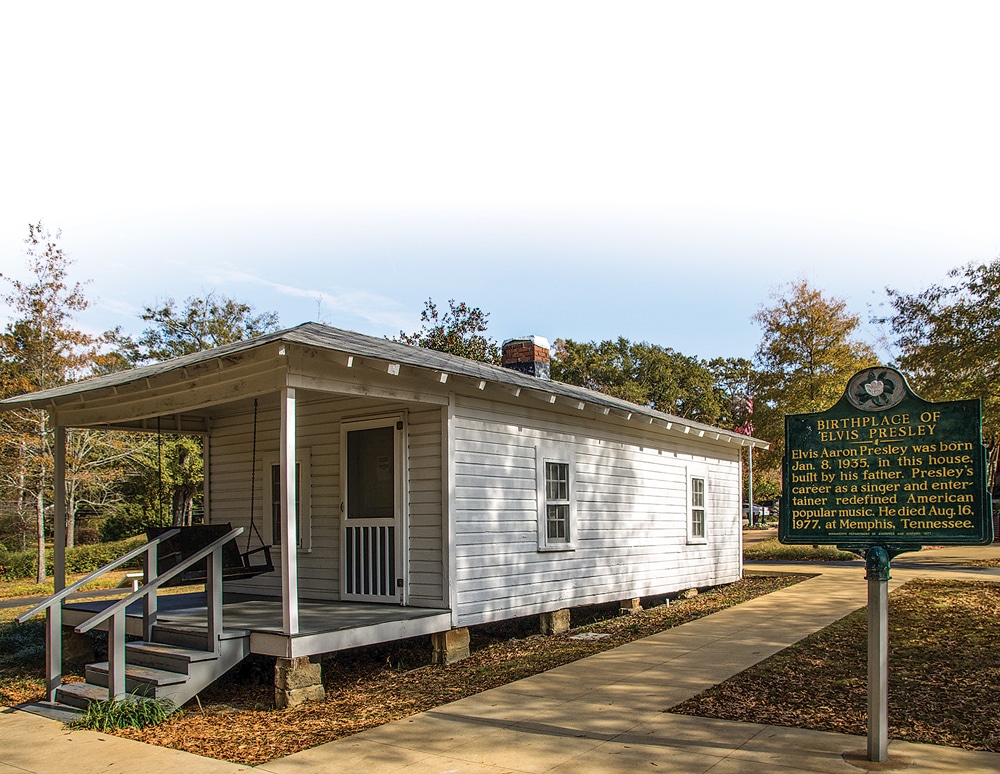
And of course, Tupelo is world-famous as the birthplace of Elvis Presley and is now home to the museum honoring him. Here you can tour the two-room shotgun house built by his father where Elvis was born in 1935, attend a Pentecostal church service where Elvis fell in love with gospel music, review important milestones in his life and read memories from people who knew him when and before when.
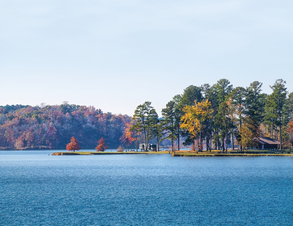
While exploring this area, I stayed at the U.S. Forest Service campground at Davis Lake in the Tombigbee National Forest. Even though it is 4 miles off the main road and 20 miles past Tupelo, it turned out to be my favorite place to stay. Anytime I can get waterfront property with water and electric hookups, and a discounted rate for seniors, I’m the happiest of campers.
At milepost 193 is Jeff Busby Campground, another NPS facility, and the smallest one with only 18 sites. But again, even though heavily wooded, the campground is easy enough to maneuver through with large campsites and some pull-throughs.
French Camp Historic District (milepost 181) is nearby and includes a museum where you can tour various historic buildings, stroll among a quaint log cabin village and have lunch at the Council House Café.
There are a couple of easy woodland trails where bald cypress thrive in swampy backwaters and you can see other beautiful trees like the black oak and tulip poplar. My favorite one south of here was Cypress Swamp, maybe because I heeded the invitation on the sign at the entrance:

Just 4 miles off the Parkway at milepost 243 is Davis Lake Campground with 24 sites – 14 of which are lakeside – flush toilets and a dump station.
“You are entering a realm of trees, water and reflections. Its subtle beauty and peaceful setting can soothe a tired soul. The trail is easily walked in 20 minutes, but a relaxed pace improves the likelihood of seeing wildlife. Along the way, you may experience the wonderment of discovery. Allow enough time for the magic to work.” Magic indeed – don’t miss this one.
The last NPS campground heading south on the Trace is Rocky Springs (milepost 54). I stayed here a couple of nights and really enjoyed the exquisite, quiet darkness at night and the massive sites, many of which can fit two RVs on one pad. I met a group from Canada who make an annual trip down the Trace and we swapped “must-sees,” each being able to tell the other of sights we shouldn’t miss, another great thing about RVing. The campground is close to the trail that leads to the ruins of the town of Rocky Springs, which was once occupied by Ulysses S. Grant during the Civil War. Settled in the late 1790s, it was once a thriving farming community until the Civil War, yellow fever and crop insects left it desolate and deserted. However, a church built in 1837 is preserved and you can also meander along another section of the Old Natchez Trace.
The section of the original road near here is called The Sunken Trace (milepost 41.5) and is said to be the most photographed part. It really is quite fascinating to see how the heavy traffic wore the road down when in the late 1700s and early 1800s, it was simply known as the “Path to the Choctaw Nation.”
My advice to other RVers is not to hurry along – take your time to soak it all in, stop at all of the pull-offs, learn a little about the history of the area …
Coming to the end of my journey on the Parkway at the beautiful city of Natchez, Mississippi, I was sorry I didn’t have more time to explore Natchez’s historic buildings and old plantations. I had spent a little more than a month on the Parkway and my advice to other RVers is not to hurry along – take your time to soak it all in, stop at all of the pull-offs, learn a little about the history of the area, walk the scenic paths, tour the historic buildings and let yourself get a little lost in time. It’s definitely a worthwhile, unforgettable trip.
Fall Foliage

According to the NPS, these are some of the top sites to view fall color along the Parkway.
- Little Mountain Overlook in the Jeff Busby Campground | milepost 193.1
Natchez Trace National Scenic Trail from:
- Old Town Overlook Trailhead | milepost 263.9
- Beech Springs Trailhead | milepost 266
- Garrison Creek Trailhead | milepost 427.6
- Old Trace Trailhead | milepost 426.3
- Freedom Hills Overlook | milepost 317
- Old Trace Drive | milepost 375.8
- Metal Ford | milepost 382.8
- Meriwether Lewis | milepost 385.9
- Fall Hollow | milepost 391.9
- Swan View Overlook | milepost 392.5
For More Information
Natchez Trace Parkway
800-305-7417
www.nps.gov/natr


