A Scenic Drive Runs Along the Spine of this Crescent-Shaped Rise that Juts Abruptly from the Table-Flat Mississippi River Delta Lands of Arkansas and Missouri
The St. Francis River, thickly lined with overhanging trees clear to the water on both sides, swings a wide, milk-chocolate arc past the tiny town of St. Francis, Arkansas (pop. 250). It outlines the west edge of the Missouri Bootheel, and helps shape the boundary between the Natural State’s northeast corner and the Show-Me State.
Crowley’s Ridge Parkway National Scenic Byway begins here at St. Francis. It follows the ridge, a crescent-shaped anomaly that ranges in width from 1 to 12 miles, towers some 200 feet above the table-flat Mississippi River Delta flood plain on either side of it and continues south to Helena. There, this oddity of nature ends abruptly at the Mississippi River.

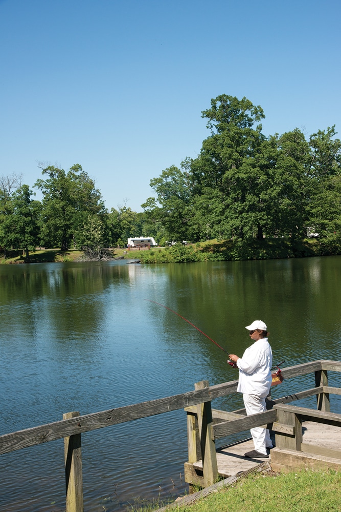
A fisher tries her luck from the first-rate fishing pier at Bear Creek Lake.
Trenched through by the St. Francis River, the ridge actually continues north into Missouri, nearly to Cape Girardeau, but just the Arkansas stretch is a national scenic byway, designated in 1998.
The ridge itself, St. Francis to Helena, spans 150 miles, while the parkway, with its numerous twists and turns, measures nearly 60 miles more. It’s an elegant parkway, a serpentine route over rolling hills, passing through a lush, pastoral landscape, a world of hardwood forests, wide-open fields of feathery prairie grass and wildflowers, tree-statued parks with glittering lakes and dozens of small farms. There’s also a string of sleepy burgs and a few larger, bustling communities with shops, restaurants and museums.
We’ve followed the drive several times over the years, and in both directions. It’s fairly well marked both ways, but better north-to-south. Thus we recommend traveling this direction.
For simplicity’s sake — because driving certain parts of the ridge would be difficult with our fifth-wheel in tow — we camped two nights at Crowley’s Ridge State Park near Paragould, leaving our trailer there while touring the ridge’s north half. Then we did the same at the elegant new Mississippi River State Park near Marianna while touring the south end.
Crowley’s Ridge, made up of clay and gravel topped with loess (German for “loose soil”), began to take shape more than 50 million years ago when the Gulf of Mexico, which had covered the region, receded, leaving behind sediment. At the time, the Mississippi River flowed west of the ridge, the Ohio River east of it, both larger and more powerful than their modern-day counterparts. The swift currents dug ever-deeper channels, leaving behind a sliver of land, the ridge.
The grinding action of glaciers to the north reduced rocks to “flour,” or loess, which was carried south by wind and glacial melt-water, and deposited on the ridge. Earthquakes also played a role, said Tara Gillanders, interpreter at Mississippi River State Park, and lifted the ridge higher and tilted adjacent land, which in turn shifted the rivers away and prevented erosion. Thus, much of the biology atop the ridge is “unique in Arkansas,” she said, more similar to Eastern forests.

The 1888 courthouse of Greene County at Paragould.
Benjamin Crowley, for whom the ridge is named, was the first to settle here, in 1825, on a land grant he was given for his service in the War of 1812. At the time — and until the end of the 19th century — Crowley’s Ridge provided the only reliably dry north-south route through this otherwise swampy part of the state. It served originally as a buffalo trail, then Indian trail, and eventually postal road and military route. Today’s designated scenic drive follows a cobble of dozens of roads, sometimes leaving the ridge (where no roads are adequate) for several miles.

A ruin of a barn near the ghost town of Bay Village.
Our first stop (a short side trip) was at Chalk Bluff Natural Area just northwest of St. Francis (turn right off U.S. Highway 62 onto County Road 341, then right on County Road 347). During spring, summer and fall (this time, we were there in May), roadsides here — and elsewhere along the drive — are festive with wildflowers, thick swaths of white daisy-like oxeye, blue and purple asters, pink primroses, lavender vetch and yellow sunflowers, and the air is sweet with honeysuckle.
The 35-foot red-and-white-clay bluff, which resembles chalk, hence the name, towers over the St. Francis River. Asphalt paths wind through the area, leading to the river (beware the acres of poison ivy), and placards along the way tell its story. The bluff, “one of the most important historical landmarks in Arkansas,” marked a major crossing point for raids between Arkansas and Missouri during the Civil War. Finally, in July 1863 Union cavalry crossed and began a drive down Crowley’s Ridge that ended with the capture of Little Rock two months later.
Return to the Parkway and continue south to Piggott, seat of Clay County (each of the eight counties the parkway crosses has a seat along it), with a quaint, flourishing downtown and the nearby Hemingway-Pfeiffer Museum and Educational Center. Ernest Hemingway’s second wife Pauline Pfeiffer’s wealthy parents had a fine 1910 Queen Anne home, which the young couple visited often during their 13-year marriage. Hemingway enjoyed quail hunting trips on the ridge, and in a barn-studio near the house, wrote much of his novel, A Farewell to Arms. Guided tours of the home are available.
Follow the drive to Greene County seat Paragould, established in 1882 when two rival railroads — led by Jay Gould and J.W. Paramore (hence the town’s name) — laid tracks that crossed here. A fine, red-brick 1888 courthouse is here, and on its lawn a 7-foot-tall Statue of Liberty replica, a memorial to American war veterans. Murals recall the town’s railroad heritage.
Crowley’s Ridge State Park, one of the six originals of Arkansas’ 52 state parks, is just outside the town, on Benjamin Crowley’s thickly wooded homesite. The park’s Lake Ponder includes a snack bar and bathhouse, and offers swimming and pedal boating, and nearby 31-acre Walcott Lake, with a boat launch and pier, offers fishing for a variety of stocked fish. Year-round camping (18 RV sites with water, electricity and dump site) is available.
A handful of miles ahead, 135-acre Lake Frierson State Park is adjacent a 350-acre lake of the same name that is considered one of the top fishing spots in northeast Arkansas. The park is especially lovely in spring, when the blooms of abundant dogwood trees dot the woods like spatters of buttermilk.
Continue to Jonesboro, pop. 57,263, the largest city in the Arkansas Delta, and seat of Craighead County. Arkansas State University is here, as is the first-rate Forrest L. Wood Crowley’s Ridge Nature Center, located at the ridge’s widest section (12 miles).
Exhibits and a film here explain how the ridge came to be. A three-story “cutaway” to a background of recorded bird songs displays a cross section of loess with trees and numerous mounted animals native to the area. A 300-gallon aquarium contains a dozen creatures that call Crowley’s Ridge home: an alligator snapper, red-ear slider (water turtle), spotted gar, American alligator and others. Outside, a path winds through a swamp typical of the area. The tannin-black water is rife with fish and turtles.

At Chalk Bluff, the St. Francis River, which is thickly lined with overhanging trees, cuts through Crowley’s Ridge, separating Arkansas from Missouri.
Continue south to Lake Poinsett State Park at Harrisburg. There’s fishing on the 640-acre lake, and fishing boats, canoes and kayaks can be rented. There are also hiking trails, a visitor center with a gift shop, a variety of programs and a campground with more than two dozen sites.
Fifteen or so miles south along the parkway, near Birdeye, Arkansas State Veterans Cemetery, which includes a columbarium, is newly opened. It’s a lovely, peaceful place, lavish with bright wildflowers.
Ahead at Levesque we suggest taking a 10-mile side trip east to Parkin Archeological State Park on the St. Francis River. Native Americans lived at the 17-acre site, now a National Historic Landmark, from A.D. 1000 to 1550. Though many other similar archaeological mound-builder sites in the region have been destroyed, Parkin is well-preserved and opens a window onto life during that time period.
Return to the parkway and continue south to magnificent Village Creek State Park outside Cross County seat Wynne. The 7,000-acre park, located in a long, wide valley, lies along the Old Military Trail (later the Memphis-Little Rock Road), which, completed in 1829, provided the first real access to the area for settlers, and also served as an Indian Removal route between 1832 and 1850. Sections of the old road, sculpted deep in the loess by the passage of many feet and wagons, can still be seen. The park offers fishing, swimming and boating on its two lakes, a picnic area, visitor center, special events, hiking and horse trails, and a fine campground.
Forrest City, pop. 14,774, seat of St. Francis County and named for Confederate General Nathan Bedford Forrest, is ahead. Crowley’s Ridge, visible from south of town, stretches — imposing and formidable — along the eastern horizon.
A placard in the town notes that in 1866 (a year after the war ended) General Forrest and 1,000 workmen pitched camp here, and within two years had cut through the ridge and laid track for the Memphis and Little Rock Railroad. Trains soon ran regularly, creating a thriving business district, and by 1892, most buildings in the town were of brick. St. Francis County Museum (open Tuesday through Friday, 10 a.m. to 4 p.m.) now occupies the once-fine gray clapboard J.O. Rush House.
South of town — and growing thicker the farther south you go — heart-leafed kudzu vines are swallowing stretches of roadside. The vines, planted by the Civilian Conservation Corps 80 years ago in an unsuccessful attempt to stop erosion, though lovely, are engulfing the trees, turning them into surreal, green, Easter-Island-like statues. Outside Marianna, the parkway crosses the L’Anguille River, creating the only break in the Arkansas segment of the ridge.
Drive through Marianna, seat of Lee County, where a small park in the heart of town displays a statue of General Robert E. Lee atop a 25-foot-tall obelisk, and continue to 24,000-acre St. Francis National Forest. Elegant Mississippi River State Park, which eventually will encompass 536 acres, is here, newly sculpted from the forest.
The park offers fishing at Storm Creek Lake, and wildlife viewing opportunities at the Audubon Great River Birding Trail (deer, waterfowl, bald eagles, gray and fox squirrels, alligators and more). Bear Creek Lake Recreation Area includes one of the finest campgrounds we’ve seen, immaculately groomed, with 14 paved, full-hookup sites that provide spectacular views of the lake and surrounding woods.
The final 16 miles of Crowley’s Ridge Parkway, this stretch also called the St. Francis Scenic Byway, run south from the park toward Helena along a lonely serpentine road of well-maintained gravel. Trees along it weave a green canopy high overhead, and here and there you pass thick stands of cane, 12-foot-high yellow stalks with feathery green leaves.
Occasional unnamed roads bored through the thick loess meander off the main route for interesting exploring. We followed such a road just past the turnoff for Horner Neck Lake, to a brown-crystal stream, its still water perfectly mirroring overhanging trees and vines. Elsewhere, the byway climbs high for wide panoramas and periodic glimpses of the Mississippi River.
The last 4 miles of the drive are paved, from Storm Creek Lake Recreation Area south to Helena, the state’s second-oldest incorporated town, and end of the line at Arkansas Highway 242. The antique cotton-and-riverboat town, rich in history, was home to early Native Americans as far back as 500 B.C., and was the site of an important Civil War battle, when in July 1863, Union forces, which had occupied Helena a year earlier, thwarted a Confederate attempt to retake the city. Placards at newly dedicated Freedom Park tell the stories of Freedom in Helena and President Lincoln’s Proclamation of Emancipation.
Now, Helena is home to the popular annual Arkansas King Biscuit Blues Festival, and to the first-rate Delta Cultural Center. Also a visitor center for the parkway, it offers a wealth of information about tree-shrouded Crowley’s Ridge, an imposing, dominant presence in the town.
Travel Information

Young visitors at Crowley’s Ridge Nature Center in Jonesboro, Arkansas, get a close-up view of one of the exhibits that showcase the area’s wildlife.
Arkansas Delta Byways
State University, Arkansas
870-972-2803
www.deltabyways.com
Arkansas State Parks
Little Rock, Arkansas
501-682-1191
www.arkansasstateparks.com
Crowley’s Ridge State Park
Walcott, Arkansas
870-573-6751
Lake Frierson State Park
Jonesboro, Arkansas
870-932-2615
Lake Poinsett State Park
Harrisburg, Arkansas
870-578-2064
Mississippi River State Park
Marianna, Arkansas
870-295-4040
Parkin Archeological State Park
Parkin, Arkansas
870-755-2500
Village Creek State Park
Wynne, Arkansas
870-238-9406