Standing the test of time, the Granite State has more than 50 covered bridges, antique treasures from a slower and simpler American lifestyle
Today, many of the country’s venerable covered bridges can’t be driven over in motorized vehicles. And where driving is allowed, it’s limited to slow-moving motorcycles or automobiles, nothing bigger. You likely won’t encounter most historic covered bridges unless you go looking, and you certainly won’t come across them on freeways.
But the antique treasures can still be found on picturesque back roads in more than half the U.S. states. Back when bridges were made exclusively of wood, generally untreated, a roof and walls would be added to protect the deck from the weather, giving it a longer service life. A cover also provided shelter from the elements to travelers, and reassured horses and livestock that may have been alarmed by rushing water.
My husband, Guy, and I have gone in search of these anachronistic gems on a number of occasions — our travels often involve following “trails” of one sort or another. We were pleased to find on a recent trip to the Northeast that New Hampshire has preserved 54 of the more than 400 covered bridges that once graced its many waterways.
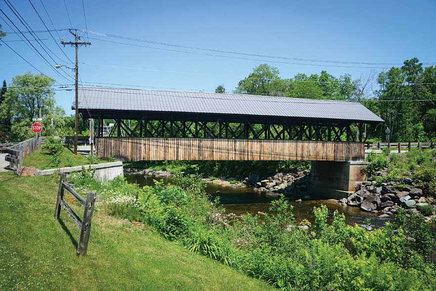
Built in 1862, the beautiful Mechanic Street Bridge in Lancaster is also known as the Israel River Bridge.
Between 1805 and 1885, some 10,000 covered bridges were built in the United States, many of them in New England. Various configurations were used, but all covered bridges consisted of a roadway supported on either side by a wooden truss and a roof. The framework was of heavy timbers or “chords” connected with diagonal or vertical trusses in half a dozen or so patterns, fastened together with wooden pins or “trunnels.”
The use of coal-tar creosote to treat the wood, begun a century and a half ago, changed bridge building.
The first pressure-creosoting plant in the United States appeared in 1865, with others built over the next half century. As using creosote-treated wood became commonplace, adding a cover was no longer necessary.
Another turning point in bridge building had come earlier, in the 1840s. Before that, most bridges were built entirely of wood. But in 1840, architect William Howe of Massachusetts patented a truss design that replaced wooden vertical posts with cast-iron rods. The Howe truss was considered the crowning achievement of the wood-bridge era.
But improved steel and concrete spelled doom for wood in bridge building, and by 1950, the year the National Society for the Preservation of Covered Bridges was formed, only about 1,500 remained in the United States. Others had succumbed to flood or fire, or simply neglect. In New Hampshire, in 1963, covered bridges became the first type of historical structure specifically protected by state law.
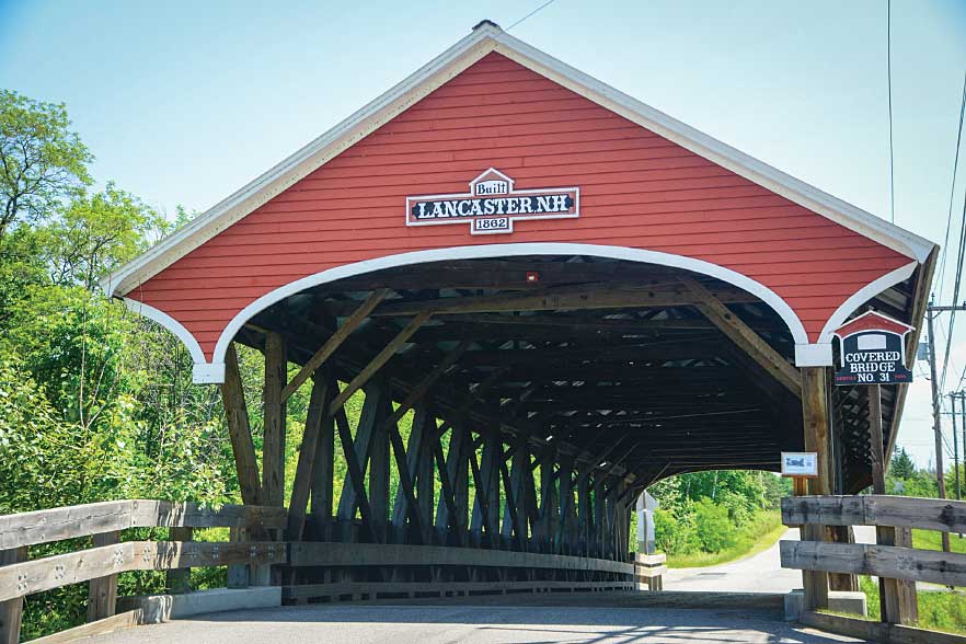
The Mechanic Street Bridge connected the mechanics of the town with the farmers across the river.
In 1987 Congress declared it to be “in the national interest to encourage the rehabilitation, reuse and preservation of bridges significant in American history, architecture, engineering and culture. Historical bridges are important links to our past … and can represent significant resources for the future.”
Each state was required to inventory its bridges to determine significance and address “rehabilitation, retention and study of historic bridges.” “Historic” applies to any bridge eligible for listing on the National Register of Historic Places, created in 1966.
Many of New Hampshire’s 54 preserved covered bridges are on the National Register, and others may eventually be added. Elizabeth Muzzy, director of the New Hampshire Division of Historic Resources, says the bridges are “among our most beloved icons.” She adds that “creating your own tour of them is a great way to see the Granite State.”
On our recent visit, Guy and I decided to go in search of the state’s covered bridges, with the goal of seeing as many as possible in two days. We began in quaint Lancaster, which lies a few miles west of the White Mountain National Forest in the Connecticut River Valley. Three historic bridges are in the area.
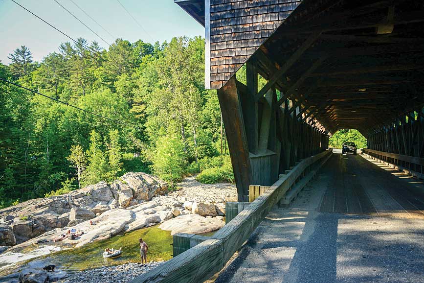
Mechanic Street Bridge, just east of U.S. Route 2 in the town, crosses the Israel River, a boulder-laden stream, which, according to a sign, provided water power to the town’s early industries. The original 1780s’ bridge became inadequate for the growing community, and in 1862 the current bridge, a 94-foot-long Paddleford truss, was built, “enabling horses and carriages to cross faster.” There have been two renovations, in 1962 and 2006, and passenger cars may drive across today.
Edna Surridge of the Lancaster Visitors Center provided directions to the two other area bridges. Take Elm Street west from Route 2, opposite Mechanic Street. Follow the narrow, winding road for 5 miles (passing an odd Stonehenge-like rock formation along the way) to the one-lane 1911 Mount Orne Bridge just west of State Route 135. Also called the Lunenburg Bridge, the 266-foot-long Howe truss structure crosses the Connecticut into Lunenburg, Vermont. (Note: You can’t drive your RV across the covered bridges, and turning around at some can be tricky, so be sure to plan ahead.)
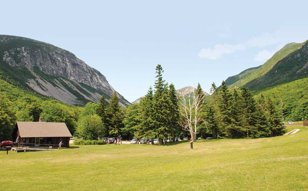
Stunning Franconia Notch is a major pass through the White Mountains. Interstate 93 transits the Notch but required an act of Congress, as it could only be a two-lane road.
From Lancaster drive north 9 miles on U.S. Route 3 to Groveton Village, where the 1852 Groveton Covered Bridge crosses the Upper Ammonoosuc River. This 126-foot-long Paddleford truss bridge owes its excellent condition to Route 3 being rerouted in 1939, bypassing the bridge.
Return to Lancaster on Route 3 and continue south, passing Weeks State Park on Mount Prospect, named for U.S. Senator John Wingate Weeks, sponsor of legislation in 1910 to create the White Mountain National Forest. The road is good but steep, including a 14 percent grade into the antique town of Whitefield. Towering slate-blue mountains, thickly treed, rise on all sides, and mountain meadows are festively spiked with purple lupine.
Route 3 joins Interstate 93 near Franconia and continues south.
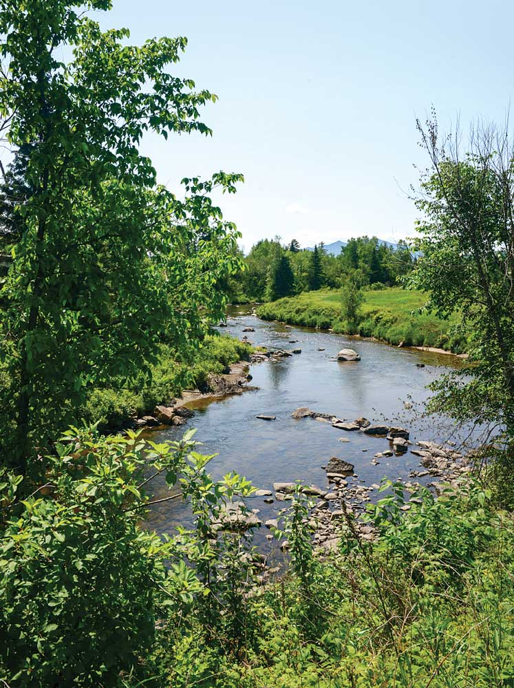
The Israel River makes its rocky way east of Lancaster near three antique bridges.
The Frost Place, a short drive west on I-93, is worth a visit. Once home to poet Robert Frost and now owned by the town of Franconia, it’s a nonprofit educational center for poetry. Mountain views from the front porch are stunning.
Return to I-93/3 and continue south through dramatic Franconia Notch, a major pass through the White Mountains. Here the interstate is a super-two-lane parkway, one lane in each direction, with a 45-mph speed limit. The road was a compromise between the government, which wanted a four-lane route, and environmentalists, who had concerns about the impact such a highway would have on Franconia Notch.
The “notch” is bordered to the east by Franconia Ridge, six massive mountains ranging in height from 4,300 to 5,200 feet, and to the west by 4,100-foot Cannon Mountain and the sheer face of Cannon Cliff. Here in the heart of the national forest is 6,700-acre Franconia Notch State Park, which straddles the interstate for 8 miles, from Echo Lake to the Flume, and includes a number of attractions.
These are extremely popular, and parking can be a problem. But we found a spot at the Basin and, among dozens of others, walked the trail through the woods along aptly named Pemigewasset River, Abenaki for “swift current.” Roaring white water races along, seemingly every which way, foaming down chutes and falls to the Basin, a large swirling-water “pothole.”
The 30-foot-diameter, 15-foot-deep hole began taking shape some 25,000 years ago as the Ice Age came to a close. Water from the melting glacier bored deep through the granite bedrock, and for thousands of years spinning sand and stones created the pothole or “basin.” Naturalist Henry David Thoreau, here in 1839, called it “perhaps the most remarkable curiosity of its kind in New England.”
Franconia Notch State Park offers other attractions, notably Cannon Mountain Aerial Tramway (cable cars climb 4,180 feet to the summit), Echo Lake Beach and the Flume (an 800-foot-long, 90-foot-deep gorge where a boardwalk has been built). Admission is charged for these.
Two covered bridges cross the Pemigewasset at the Flume. Flume Bridge, built in 1871, is a 50-foot-long Paddleford truss with a hiker’s walkway attached to the north side. Small park buses cross this bridge; visitors’ vehicles may not.
Sentinel Pine Covered Bridge, a 60-foot-long “stringer,” crosses the river at the “pool.” This walking bridge, new in 1939, was built atop a 60-foot section of a white pine that had stood “like a sentry” nearby, towering 150 feet high before a storm toppled it a year earlier.
In the town of Bath, a car crosses the 158-foot-long Swiftwater Bridge, built in 1849, as bathers sun themselves on the rocks of the Wild Ammonoosuc River below the historic span.
Continue to State Route 112 and turn right toward historic Bath. Swiftwater Covered Bridge, a Paddleford truss with added arches, crosses the Wild Ammonoosuc River east of town. The 158-foot-long Swiftwater, built in 1849, is the fourth bridge to stand at the site.
In the historic district of town, 256-foot-long Bath Covered Bridge, a Burr truss, fifth to be built on the site, spans the now-placid Ammonoosuc, providing bucolic views in both directions. Five miles west in Woodsville Village, the Ammonoosuc widens dramatically into a dam-created pool where the 374-foot Haverhill-Bath Covered Bridge, a Town lattice truss, crosses it. Water thunders over the dam under the bridge, which, at age 189, is the oldest covered bridge in the state still in use, though only to foot traffic since 1999. It was restored most recently in 2004.
From Woodsville Village, drive south on State Route 10. We suggest a brief stop at lovely Haverhill Common in North Haverhill. Bordered by imposing white-frame historic homes, the common, fenced with rough-hewn stone posts, was once pastureland for farm animals. Continue south through Lyme, founded in 1761, to Hanover, where we suggest a drive through Dartmouth College campus. Chartered in 1769, it’s one of nine colonial colleges in operation before the American Revolution.
Where the road divides at West Lebanon, continue south on State Route 12A. Just north of Saint-Gaudens Road, which leads to Saint-Gaudens National Historic Site, watch for a small “Covered Bridge” sign at Mill Road on the left. The road is narrow and winding, and the secluded bridge, the Blow-Me-Down, is about a mile ahead. Folks in New Hampshire are gracious about letting RVers use their driveways to turn around, but it’s best to ask first. Drivers in the state are similarly considerate, waiting patiently while RVers make difficult turnarounds.
The Blow-Me-Down, a king-post truss, built in 1877, crosses a leafy gorge on Blow-Me-Down Brook. Guidebooks say it’s in Cornish, but a local resident, Steve, who drove us there in his Jeep, said it’s actually the tiny community of Squag City. The 85-foot bridge is open for auto traffic, though the road is little traveled.
Continue south on Route 12A to Saint-Gaudens National Historic Site, home to one of America’s greatest sculptors, Augustus Saint-Gaudens (1848 to 1907). Among his many masterpieces are the $20 “double eagle” gold coin, and bronze monuments to Civil War Admiral David Farragut and General William T. Sherman, a graceful Diana, and a “Standing Lincoln” commissioned for Chicago’s Lincoln Park.
Through the efforts of the National Park Service, the state of New Hampshire and numerous foundations, the 12-foot-tall Lincoln, “captured in physical appearance and spirit,” was recently recast from Saint-Gaudens’ molds, and was to be dedicated in 2016 at the sculptor’s historic site. We’d known it was coming, but didn’t know exactly when — or when we’d be there — and thus, as we arrived on June 26, we were surprised and delighted to see several thousand folks gathered for the event, which was about to begin.
Shrouded by a parachute, the Lincoln stood nearby during speeches by Governor Maggie Hassan, Metropolitan Art Museum Curator Thayer Tolles, NPS Associate Director Stephanie Toothman, noted historian Harold Holzer and others. The 12th New Hampshire Volunteer Regiment Serenade Band played Civil War-era music. Then the parachute was whisked off, and the magnificent Lincoln revealed.
Numerous works by the sculptor are displayed at the historic site, as are his fine home and gardens, studios and much more, including 80-acre Blow-Me-Down Natural Area with a 2-mile hiking trail.
Continue south a quarter mile on Route 12A to the 1866 Cornish-Windsor Bridge over the Connecticut. The fourth bridge to connect Cornish, New Hampshire, and Windsor, Vermont, the 460-foot-long Town lattice truss is the longest wooden bridge in the country and the longest two-span covered bridge in the world. Originally a toll bridge, as were many of the others, the Cornish-Windsor was bought by the state of New Hampshire in 1936 and became toll free seven years later.
A mile south, turn left on Town House Road, then Mill Village Road to Root Hill Road, where the Dingleton Hill Covered Bridge crosses Mill Brook. New in 1882, the 80-foot multiple-king-post truss was rebuilt 101 years later. Turning around here is awkward; you must back into Mill Village Road.
We settled on McDermott Covered Bridge at Langdon as the last stop on this two-day trek. It’s about 30 miles south of Cornish, a scenic route through more of the state’s historic towns and elegant countryside.
Follow Route 12A and continue on Route 12 where the two merge at North Charlestown. At the town of Cold River, turn left on State Route 123 to Alstead. Just past the town, the road splits; take Route 123A and turn left on Crane Brook Road at the whimsical woolly mammoth statue.
The McDermott Covered Bridge and a “Welcome to Langdon, Established 1787” sign are just ahead. A placard on the bridge provides details. The 89-foot Town truss was built in 1864, restored from 2002 to 2007, and rededicated in 2008. A new bridge across the river nearby now carries Crane Brook Road, and the McDermott is closed to auto traffic. You can still walk it, however, which we did.
Thus ended our covered-bridge odyssey through New Hampshire. Director of the New Hampshire Division of Historic Resources Elizabeth Muzzy has it exactly right: We can’t imagine a more pleasant way to see the Granite State.
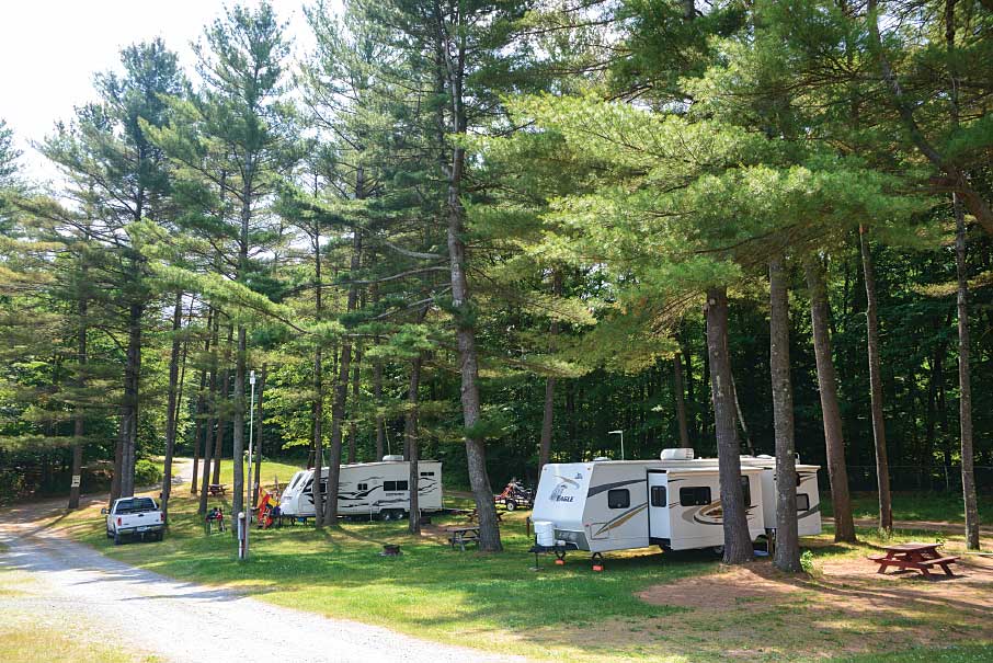
The authors discovered picturesque RV parks along the way, but it is best to make reservations in advance.
Where to Stay in the Granite State
New Hampshire has more than 100 commercial RV parks and public campgrounds, including 15 Good Sam Parks that offer members discounted campsites. To find them all, visit Good Sam’s online guide to North American RV parks and campgrounds or purchase the 2018 edition of the Good Sam RV Travel & Savings Guide on the Camping World website.
www.campingworld.com/2018guide
www.goodsam.com/travel/campgroundsandrvparks
For More Information
The website of the National Society for the Preservation of Covered Bridges offers a state-by-state guide to historic covered bridges, with GPS coordinates and detailed descriptions, plus links to other helpful websites.
www.coveredbridgesociety.org
The New Hampshire Division of Historical Resources provides an online guide to the state’s covered bridges that is searchable by bridge name or town.
www.nh.gov/nhdhr/bridges