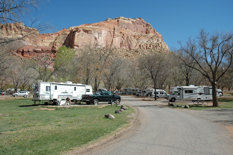
After driving up the amazing Water Pocket Fold from Bullfrog Marina on Lake Powell, Utah, following the Burr Trail and Notom-Bullfrog Road, we found ourselves at the Capitol Reef National Park Visitor Center. The Fruita Campground was a comfortable place to make a plan and pick up some fresh berry pies at the old Gifford Homestead. Looking for another interesting backroad, a park ranger had mentioned the Cathedral Valley Loop.
This often-overlooked 59-mile road leads to what is arguably the most spectacular area in the whole Capitol Reef National Park. I say “arguably,” because few of our national parks have so many astounding features, all easily reached by vehicle.

The Fruita Campground, located within Capitol Reef National Park, offers a comfortable place to stay.
The loop road is accessed via the Hartnet Road, 11.7 miles from the visitor center where we zeroed our trip meter. If you can, it’s a good idea to air your tires down for backroads. For example, we’ll go from a 65 psi highway pressure to 35 psi when we leave the pavement. This improves the ride immensely, and greatly reduces the possibility of a flat from a sharp rock. It’s important to air back up when you return to the blacktop.
Right off the bat, we forded the Fremont River. It was sort of a blind crossing. Entering the water just off Highway 24, we drove downstream a short distance before exiting on the far side. We did check at the visitor center to make sure the water was not dangerously deep, which it can be. The ford is exciting, but can be done in any SUV dinghy vehicle with reasonably good clearance. Four-wheel drive is not necessary.
Heading north through the Bentonite Hills we wound our way past colorful mounds that resembled giant candy-striped Easter eggs, the remnants of vast river systems that left bentonite clays from altered volcanic ash. Climbing out of the hills, we wandered through a valley of sagebrush, its pungent fragrance mixing with the dry desert air. It was round-up time. A couple of cowboys moved some strays along the dusty track.
A turnoff led to the South Desert and Jailhouse Rock, an easy walk down an old mining road. Comical hoodoos (rock spires) posed for pictures. Back on the road, the turnout for the South Desert Overlook gave us an overview of the desert from a high bluff. It looked like the Serengeti Plains without the wildebeests.
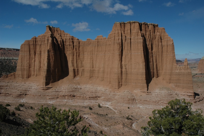
As we continued, the scenery just kept getting more spectacular. From the Upper Cathedral Valley Overlook, we had a wider view of the monoliths that gave this area its name, and indeed, the earthy red fine-grained sandstone and gypsum eroded from ancient tidal flats towering above the desert floor did resemble grand cathedrals. The 1.1-mile trail gave us staggering views of what wind and rain had carved out during the last 2 million years.
Just past Upper Cathedral Valley Overlook there is a primitive campground with six sites, but it was too early for us to stop. Then the road dropped steeply into the Upper Cathedral Valley for a different vantage point. A short walk to the old Morrell cabin is worthwhile. Built in 1920, it was home for the Paul Christensen family of eight during the summer logging season. In 1932 it was moved, log-by-log, to its present location and used for another 40 years by working cowboys. It was an interesting reminder of our Old West heritage.
Rounding the northern corner of the loop, we passed a series of black basalt dikes that had stood the test of time long after the sandstone around them was blown away and washed down to the valley floor. A little farther on, we turned off to see the Gypsum Sinkhole. If you’ve never seen this kind of sinkhole, this may be your only chance, and you most likely will never want to see another one.
On the other hand, Glass Mountain is worth a look. Actually, the strange crystals are not glass, but pure gypsum, a kind of salt. Buried at the bottom of a mineral-laden inland sea, the gypsum accumulated under later sediments. Erosion brought it back to the surface.
The last truly remarkable highlights along this route are the Temples of the Sun and the Moon in the Lower Cathedral Valley. We drove right to the base of these monoliths, towering over our heads. It’s hard to say where the best place might be to photograph these temples, or even if there is a bad place. Afternoon light is magic.
Cathedral Road twists itself south now through more bentonite hills and Mancos Shale cliffs, where the geological history presents itself in a vertical book a thousand feet high.
Evening was coming on and it was all too amazing to leave. We found a great campsite with a good fire pit in an alcove of giant boulders (N38.23.478/ W111.01.624) and spent a quiet night with our neighbors, a few jackrabbits and a distant coyote. We had only seen two other vehicles all day.
In late morning, we crossed the Caineville Wash and numerous smaller creeks and arroyos, some with water to splash through, and popped back out on the pavement of Highway 24 where we aired our tires up. It was 18.6 miles back to the visitor center. The campground was full and we needed diesel. The nearest fuel station was seven miles up the road in Torrey. After filling up, we treated ourselves to a fresh rainbow trout dinner at the Rim Rock Inn on the outskirts of town. The owner, John Sabala, graciously suggested several places where we could park our motorhome overnight in the immediate vicinity. It was the end of a perfect adventure in this hidden treasure of Capitol Reef National Park.
For More Information
Capitol Reef National Park: 435-425-3791 ext. 4111, or online at www.nps.gov/care
Rim Rock Inn & Restaurant: 888-447-4676, or online at www.therimrock.net


