The roar is audible even before we see the river. The overlook goes right to the Black Canyon’s edge, a dizzying 2,700-foot drop down to the torrential Gunnison River. We stand mesmerized and a little terrified by the unfathomable depth of the steep black granite walls and the green ribbon of water tumbling below. We are truly standing on the edge of time.
The 48-mile long Black Canyon in southwestern Colorado is one of the most spectacular natural wonders in the country and a must-see on many RVers bucket lists. It certainly was on mine when we drove five hours west from Denver over the Rocky Mountains to explore this geologic marvel.
We arrive in Montrose, a pretty community of 19,000, road-weary and ready for a break. A quick search finds two good camping choices: the Montrose KOA and Cedar Creek RV Park. The temperature is hovering in the low 90s and both parks offer shady cottonwoods, the KOA even has a tempting pool.
However, my traveling companion is smitten by Cedar Creek’s free 18-hole mini-golf course so we pull the motorhome into the park’s dappled shade and hook up.
I’m keen to get a feel for Montrose and, every Thursday in the summer, Main in Motion provides the perfect opportunity.
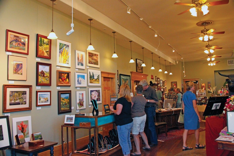
The Main Street party fills several blocks of downtown with food, live music, and vendors selling baked goods, handmade jewelry, and fresh fruits and veggies. Kids get their faces painted and climb the rock wall. Stores and galleries like Around the Corner Gallery stay open late.
Residents and visitors stroll along with snacks and cold drinks greeting friends and neighbors. We spend a couple of hours poking into booths and shops before we retreat to Simmer, a favorite local eatery, where we enjoy delicious ruby red trout. By the time we return to the RV park, mini-golf is forgotten and we tumble into bed.
Into the Canyon
We hit the road early the next morning, eager to explore the Black Canyon of the Gunnison National Park. Along U.S. Highway 50, 11 miles from Montrose, you can’t miss the park’s state Highway 347 turnoff. At the junction, we stop at Black Canyon Corner where they sell jewelry, pottery, fossils, groceries and sundries. I buy a copper bracelet and some excellent Colorado beef for tonight’s supper.
South Rim Drive, an eight-mile, two-lane paved road with easy turnouts at 12 viewpoints, offers the best perspectives of the Black Canyon. Our first stop is the visitor center where we learn that 2 million years ago the Gunnison River began to expose hard, ancient basement rocks from deep within the earth. Trapped, the river carved the canyon at the rate of 1 inch every 100 years or the width of a human hair each year.
At the Gunnison Point Visitor Center, we get our first glimpse of the magnitude of the canyon and hear the river’s relentless roar. Early explorers who tried unsuccessfully to float the canyon reported the pounding water practically drove them insane. Despite the fact that the Gunnison River is now harnessed by three dams, its voice is still powerful.
A few stops down Rim Drive at Fissures Trail, the vertical view is more dizzying and I can’t tell if the view or the 8,826-foot elevation is making my heart pound. Between Pulpit Rock and The Narrows, the canyon slims to less than 40 feet rim-to-rim and, at Chasm View, you can peer into this skinny channel. At the Painted Wall, giant magma intrusions paint the dark rock with pink stripes and we watch a pair of peregrine falcons effortlessly soar and dive into the steep canyon, suddenly disappearing, then reappearing. Everywhere we look the hillsides are a riot of flowers; mariposa, lupine, sunflower, wild rose, Indian paintbrush and prickly pear.
The last viewpoint, Sunset High Point, an easy circle turnaround for motorhomes, offers picnic tables, bathrooms, and sweeping views of the canyon and surrounding valleys. Here the 1.4-mile Warner Point Nature Trail is also a great place to stretch our legs and get a look at native plants like gnarly 800-year-old pinyon pines.
By the time we reach the park entrance, the sun is low in the west. We tour the park’s campground (one loop with electricity), but decide the abundance of brush makes the sites too narrow for our taste.
Instead, a few miles down Highway 50, we camp at Pleasant Valley RV Park, where they offer shady sites along the Little Cimarron River and a tiny café that sells “world famous” pie.
The next morning, along Highway 50, we turn in at the Museum of the West, a ramshackle gaggle of Western-style buildings, and we’re rewarded with an incredible collection of Western artifacts. Archaeologist Richard Fike has been collecting for more than 70 years and has amassed more than 500,000 pieces of authentic Western life, including entire buildings that he’s moved from nearby towns. During the two-hour, docent-led tour, we’re invited into the town’s doctor’s office, millinery shop, post office, general store and saloon to play an antique piano, pull the handle on an old slot machine and crank up the sad sweet strains of the Violano Virtuoso music machine.
A few miles south, we turn off at Cimarron, an interesting exhibit of early railroading in the canyon and site of Morrow Point Dam. This is the first place we get a sense of what it’s like to be in the Black Canyon and we feel small as we drive down the narrow road. The engine that normally sits on a rail spur over the Gunnison River has been removed for renovations. At one time, a narrow gauge rail ran through much of the canyon, zig-zagging across the river. We are able to get up close to the Morrow Point Dam, a 720-foot long, 700,000-ton concrete monolith that creates Morrow Point Lake. The river below the dam offers one of several Gold Medal places to fish, but its roaring voice here sings a softer tune.
On the Water
The Morrow Point Boat Tour (on Highway 50 at Milepost 130) offers us a chance to get on the Gunnison. During the summer, the Park Service offers twice daily pontoon boat tours narrated by a park ranger. Visitors walk 232 steps down to the river and a short distance along the old narrow gauge rail bed for a leisurely 90-minute tour through the canyon’s steep walls, learning about the geology, wildlife, early inhabitants and how dams and reservoirs shape the river and fortunes of the area’s people.
We drive southeast of Black Canyon along the Gunnison to Curecanti National Recreation Area as well as the reservoirs created by the three dams. There are plenty of places to park a motorhome, many overlooking the water. However, we hold out for Elk Creek Campground on Blue Mesa Reservoir, the largest body of water in Colorado, because it’s one of the few that offers electricity. Once we’re settled amid the sagebrush, we wish we’d brought the boat, but content ourselves with enjoying the view.
The following day, we double back on Highway 50 and turn at the Blue Mesa Dam overlook onto state Highway 92, part of the West Elk Scenic Byway. A favorite of motorcyclists, this twisty byway is filled with Gambel’s scrub oak and stately stands of aspen, their white trunks marshalling up the green hillsides like ghostly soldiers. The road continues to angle up some more at Hermit’s Rest viewpoint, offers sweeping, top-of-the-world perspectives.
Farm and Ranch Country
The road descends sharply and widens into ranch country. It’s drier here with fewer trees. A group of cows idling on the highway reminds us that this is open range. We pass Crawford State Park and note that its campground has electricity and a boat launch, but the lack of shade convinces us to press onto quaint, Western-style Crawford. This little town, population 360, has been made famous by legendary rocker Joe Cocker, who came here with his wife, Pam, and fell in love. They opened the Black Canyon Café, a surprisingly sophisticated dining establishment decorated with brilliant blue blown glass and copper hammered by local artists. While the restaurant is no longer owned by Cocker, it still serves one of the best burgers we’ve ever eaten.
We’re in Delta County now, a largely agricultural area filled with fruit stands and wineries. We stop at Sparky’s Fruit Stand and pick up a few Colorado Bing cherries to snack on. It’s getting late when we pull into Delicious Orchards Farm Market. We’re drawn in by the smell of barbecue and the strains of live music. Owner-farmer Jeff Schwartz says they hold these barbecues often during the summer and, when he spots our motorhome, offers us camping in his orchard for $5. We accept.
In the morning, we pass through the town of Delta, also known as the City of Murals. Nearly every building is painted with colorful historic scenes. We’re nearly out of town when we see the sign for Fort Uncompahgre, one of the only trading forts in the West. Historian and docent Ken Reyer leads us through low adobe buildings filled with trade goods and printed cloth that Mexicans traded local Ute Native Americans for furs. By the time our tour is complete, our heads are buzzing with images of life 150 years ago.
On Reyer’s advice, we stop by the Ute Council Tree, a 200-year-old cottonwood that marks the place local Native Americans met to make decisions. We also tour the Ute Indian Museum, a modern building brimming with clothing and other artifacts. The museum’s 8 acres also offer shady picnic tables by the river where we pause for a bit of refreshment and consider our next stop.
We decide it’s back to Montrose. After all, our time in Black Canyon country is nearly over and mini-golf still awaits.